
Driving to Mammoth Lakes, California


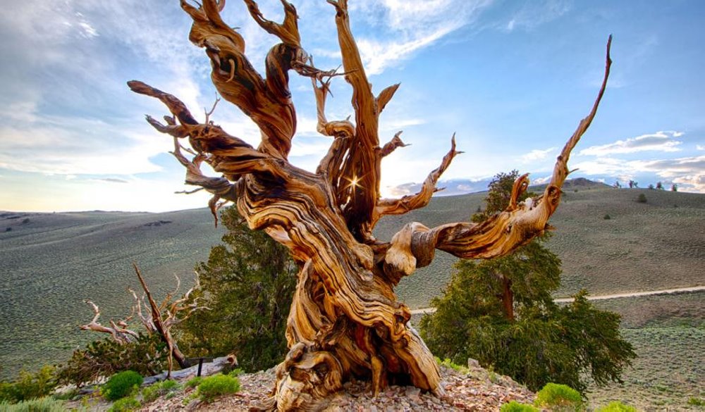
Located in the heart of the breathtaking Sierra Nevada Mountains, Mammoth Lakes is easy to access by car from anywhere in California. Road tripping to Mammoth Lakes is an experience in itself. From Southern California, you’ll pass by iconic natural wonders, including Mt. Whitney, the Ancient Bristlecone Pine Forest, and Death Valley. Traveling from the north, be sure to stop by Bodie State Historic Park or the other-worldly Mono Lake. No matter where you’re driving from, once you hit the scenic Hwy. 395 you’ll instantly feel like “the mountains are calling” as towering Eastern Sierra peaks dominate the horizon.
Driving From Southern California To Mammoth Lakes

Nothing beats the freedom of the open highway, and a road trip to Mammoth Lakes from Southern California takes travelers from the cactus-studded landscape of the Mojave Desert into the broad Owens Valley. Flanked by some of North America’s most impressive mountains and lined with ancient glacial lake beds, it’s easy to see why Hwy. 395 to Mammoth Lakes is considered a Scenic Byway. Once out of the city, the traffic density dwindles and you’re able to revel in the region’s impressive natural beauty.
Along the way, several quaint high-desert towns remind visitors of the rural Old West while providing full services to travelers. From chain restaurants to locally-famous eateries and charming hotels, visitors are able to find suitable meals and rest areas along the drive.
On the way to Mammoth Lakes, you’ll pass these iconic Eastern Sierra landmarks and scenic areas.
- Mt. Whitney
- Death Valley National Park
- Ancient Bristlecone Pine Forest
- Manzanar Historic Site
Driving From Northern California To Mammoth Lakes

Exhilarating mountain highways loaded with scenic viewpoints are part of the adventure of driving from Northern California to Mammoth Lakes. But traveling over mountain passes to this quaint mountain town changes drastically from summer to winter due to snow, so be sure to check road conditions and closures before you plan your drive.
Once the winter’s snow melts in late May to early June (although sometimes as late as July), many of the high-alpine passes that cross the Sierra Nevada Mountains open for travel. Each route has its own distinct natural beauty that begs to be explored. With several options on hand, you may want to consider taking a different route home so you can see more of the area.
On the way to Mammoth Lakes, you’ll pass these iconic Eastern Sierra landmarks and scenic areas.
- Yosemite National Park (summer only)
- Bodie State Historic Park (summer only)
- Mono Lake
Mammoth Scenic Loop to Sherwin Creek Road

This 2-hour drive begins at the outskirts of town on the Mammoth Scenic Loop. Lined with stands of quaking aspen, the paved roadway is awash with color during the autumn season. Along the way, several dirt roads lead into numerous aspen stands and to the Inyo Craters interpretive site. Combine this loop with Valentine Lake which is an often-overlooked hiking destination in Mammoth Lakes’ backyard. The secluded alpine lake is situated beneath rugged 12,000-foot peaks and the trailhead is located just a few miles south of town on Sherwin Creek Road.
The Scenic Loop is located off State Route 203, just west of the Village at Mammoth, and descends to US 395 over a distance of 7 miles. When you reach US 395, turn right to head south. Magnificent views of Bloody Mountain and Laurel Mountain are visible from the highway, each adorned with a diverse collection of colorful deciduous trees and shrubs. In 5 miles, turn back onto State Route 203 toward Mammoth Lakes and take an immediate left onto Sherwin Creek Road. This well-maintained gravel roadway winds along Mammoth Creek and is often inundated with endless fall color. As you pass the Sherwin Creek Campground, be certain to note the contrasting aspen and willow shadowed by the perpetual greens of towering ponderosa pine and white fir.
Mammoth Lakes Basin

An autumn vacation to Mammoth Lakes would be incomplete without a visit to the nearby Mammoth Lakes Basin. Surrounding the many alpine lakes, isolated groves of fluorescent aspen stand out against the expansive pine forests. Along the slopes of the rapidly rising mountains, many deciduous shrubs splash their red, yellow, and orange foliage against the rocky backdrop.
Reaching the Mammoth Lakes Basin is easy. Follow Main Street past the Village at Mammoth, continuing as the road turns into Lake Mary Road. Heading west and gaining elevation, you’ll reach the first lake in 2 miles. For more information on visiting the Lakes Basin in the fall, visit the Mammoth Lakes Welcome Center.
Driving to Yosemite National Park
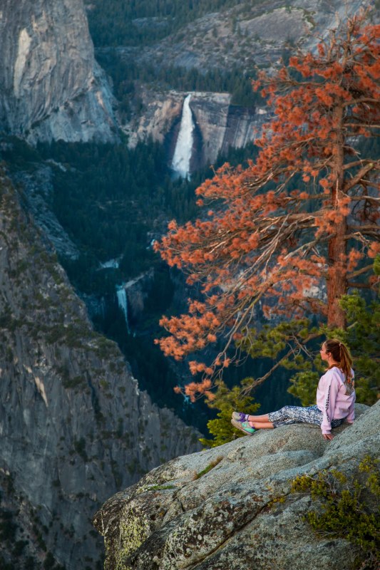
A spectacular day trip from Mammoth Lakes, California, Yosemite National Park is just a 45-minute drive from Mammoth Lakes. Hike through famous Tuolumne Meadows and dip your toes in Tenaya Lake. Iconic Half Dome, El Capitan, and Yosemite Valley waterfalls are a scenic 1.5-hour drive through the park from Tuolumne Meadows.
Driving to Mono Lake
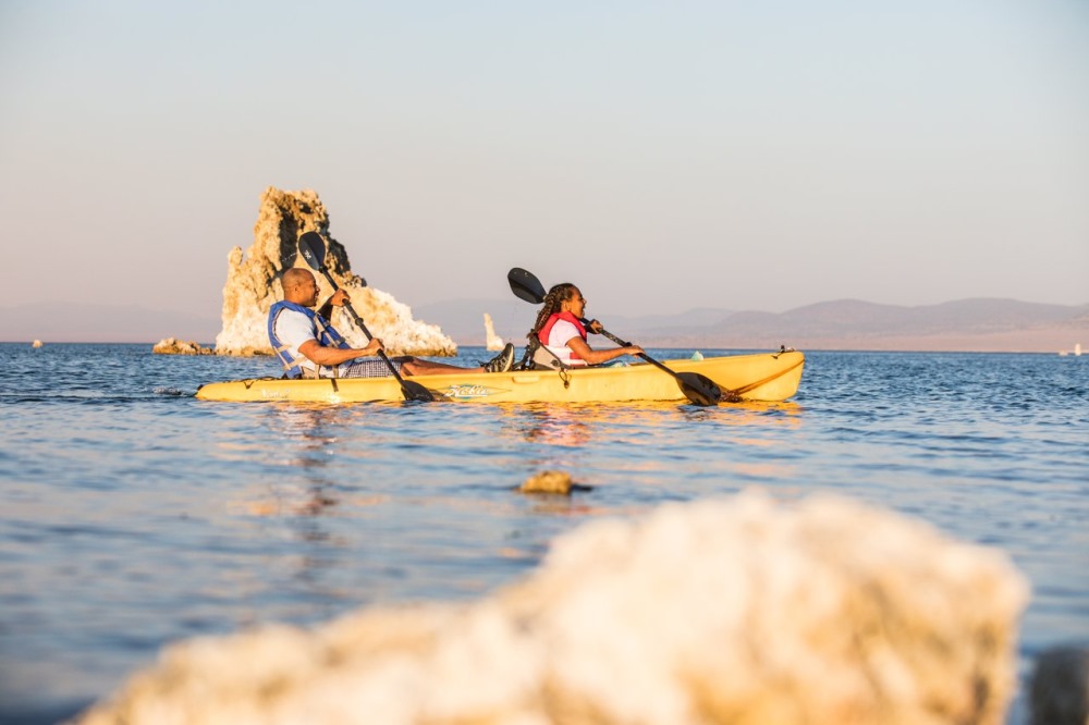
Ancient Mono Lake covers more than 65 miles and is over a million years old, making it one of the oldest lakes in North America. Mono Lake has no outlet, so water leaves only through evaporation, causing the lake to be 2.5 times saltier and 80 times as alkaline as the ocean. In 1941 Los Angeles began diverting water from the streams that feed the lake, causing lake levels to drop precipitously. Conservation efforts and litigation to reduce water exports in the last two decades have succeeded and today the lake has come back from its historic low, although prolonged drought continues to keep lake levels down and reinforces the need for water conservation throughout the state.
Driving to June Lake Loop
 The June Lake Loop (State Route 158) contains some of the most awe-inspiring displays of fall foliage accessible by automobile. From the Oh! Ridge Campground just off the roadway, visitors can gaze over an endless sea of colorful trees rimming high alpine lakes, their reflections mirrored by deep blue alpine waters. In the distance, the flanks of Carson Peak are aflame with the reds and oranges of deciduous high alpine shrubs. Further down the loop, along the banks of Reverse Creek, groves of aspen and cottonwood shower public picnic areas with a display of golden yellow.


